Tuesday, December 14, 2010

Landscaping By Water


The earth is the only planet in the Solar System on which water exists in three forms - ice, liquid and vapor. The reason it is anything other than ice is because of sunshine. The Sun not only warms the land but evaporates water from the sea and powers weather systems so that it rains back down on the hills. The winds that whip up waves are also indirectly caused by solar power. The force of the water in a waterfall or a crashing wave represents a tremendous power.

Worldwide, hydroelectric power accounts for as much energy production as nuclear power, and could provide a lot more. Every meter of the North Atlantic coastline of Europe receives an average of 50kW of power in the form of waves. Water can quite literally, in geologically short timescales, move cliffs and mountains, wearing them down, grinding them up and washing their remains away.
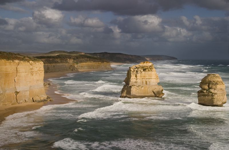
The line where land meets sea stretches for hundreds of thousands of kilometers around the world. Water may appear to be a soft chisel but it never fails to find the weakest points in rocks, splitting off boulders and cutting caves and arches through the headlands.

Waves break onto a shore in a circular motion, throwing sand or stones up the beach then dragging them back. If there is a current along the coast, the sand or stones zigzag their way with the current gradually stripping the beaches and building a long spit downstream. Over geological timescales sea level has varied by hundreds of meters, leaving raised beaches half way up present day cliffs, drowning valleys once occupied by glaciers and turning river valleys into natural harbors. In some places cliffs are being washed away into the sea faster than humans can defend them.

Monday, December 13, 2010

Rock Folding and The life cycle of a mountain range


Folding
Rocks that are deeply buried have nowhere to go if they fault, so instead they form folds. They can be broad, gentle folds those under southeast England, where the top of the fold or anticline has eroded away leaving the North and South Downs exposed and the London basin full of sediments. Such gentle folds are the comparatively minor knock on effects of the formation of the Alps. There, the collision of Africa with Europe compressed the sediments so much that folds piled northwards one on top of another in great over folds, or nappies: a vertical cliff can expose a repeating sequence of layers.

The life cycle of a mountain range

In a wide sedimentary basin, deposits accumulate layer by layer, sinking under their own weight and hardening as they are compressed these sediments laden troughs which are known as geosynclines are the potential birth place of mountain ranges of they occur between two colliding continental plates. Colliding continents begin to uplift the sediment, deforming it by folding produces symmetric anticlines and synclines. Continuing pressure may cause uneven folding and therefore asymmetric anticlines and synclines which eventually produce a recumbent fold the anticline is now in effect above the syncline and the rock layers on one side of the anticline are inverted. Further pressure may break the inverted layer, resulting in an over thrust fold. A nappe is formed when this layer disappears due to stretching and fracturing as uplift and folding continues.

Tall mountain ranges are produced by large scale faulting, the intrusion of magma domes and extrusive volcanic activity, but most importantly by large scale folding. As soon as mountains are formed weathering processes break up the rock surface and water and ice erode incisions into the mountainsides. Landslides, glaciers and rivers carry material away. The mature landscape stabilizes as rocky peaks become gently  rounded hills, rivers widen and slow, and vegetation stabilizes the soil.


Friday, December 10, 2010

World Relief and Fault Lines of Earth


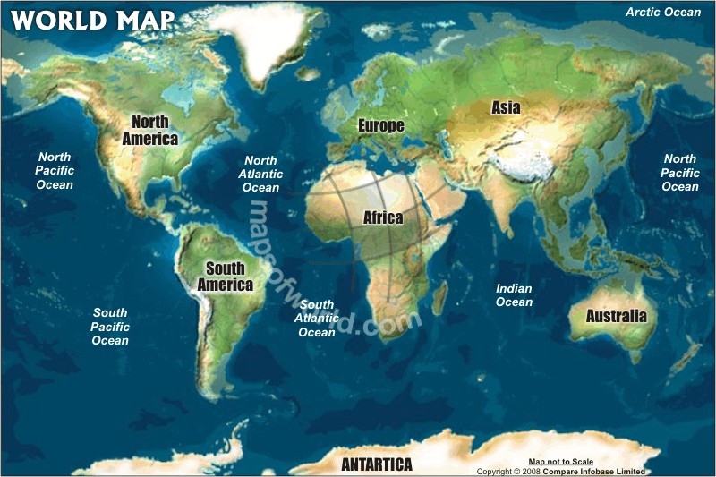
A relief map of the world reveals the structure of global mountain systems: the great backbone of both North and South America from the Rockies to the Andes, where the Pacific has pushed underneath spouting volcanoes; the high t peaks of the Alps and Himalayas where continental land masses have collided; and the ridges and wrinkles that mark ancient oceans long since squeezed out of existence. With the oceans drained, other even larger features become visible. The ocean ridge system, where new crust is formed, consists of long mountain ranges.   Isolated groups of volcanoes such as the Hawaiian chain stand out as great underwater mountains composed of millions of cubic kilometers of basalt. The ocean trenches, where crust is swallowed, plunge up to 14000 m beneath the sea, and are flanked by volcanic atolls. Thought the ancient wrinkles reveal a long history, continuing activity shows that the Earth is still a dynamic planet.
  A normal fault is where one block slides down the fault face compared with the other block. A strike slip fault is where one plate grates alongside another. The movement in this case is not vertical but horizontal. Features called horsts and grabens result from blocks moving between two faults.
 The most famous strike slop fault in the world runs from San Francisco in the north to the hills behind Los Angeles. It is the San Andreas Fault and, with its branches and tributaries, has been on the move almost continuously for thousands of years. Hardly a day goes b without a few tremors along its length.  Quakes brought San Francisco to halt in 1989 and Los Angles in 1994 but the last big ones were in 1906 and 1857 respectively.

Thursday, December 9, 2010

Rifts

Squeeze the crust together and blocks move upwards either in folds or, through brittle fracture, faults. Stretch the crust and the result is rifting. In its simplest form a single block moves down wards leaving steep ridge on either side. More often the process happens many times, so in effect a flight of steps is produced on either side. This is often accompanied by uplift since it is not pulling from the sides but the pushing of upwelling mantle rock underneath that does the stretching. So the process is often accompanied by volcanoes. The same process operates at mid ocean ridges: beneath continents it is as if a new ocean is trying to open. Recent examples of rifting processes at work include the valley of the River Rhine and Africa’s Great Rift Valley.

Forty million years ago upwelling in the mantle was splitting Africa apart. It lifted the Atlas Mountains and split open the Red sea. The crack continued down east Africa forming the Great Rift Valley. The stretching was at its greatest 3.5 million years ago when volcanoes erupted. In Kenya the volcanic material filled up the valley as fast as it was created. On the western branch of the rift, that did not happen and deep lakes fill the valley.

Monday, November 29, 2010

The Face of Earth

The Earth’s surface is the scene of a constant battle between the upward forces of mountain building and the erosional forces of wind, water and waves, aided and abetted by gravity. In the midst of all this, Human too have made their mark, in their attempts to hold back the sea, concrete over the surface and reclaim land. By removing vegetation, humans aid erosion rather than prevent it.

The features of landscape can be classified according to the predominant forces at work and the timescale during which they have been at work. In Andes and Himalayas, mountain building still dominates over erosion: parts of Scotland and Canada where once the mountains were higher are now eroded into old age. The form erosion takes depends very much on the climate. Where temperatures frequently drop below freezing, ice can act like a wedge, chiseling great boulders from the mountains.

 Glaciers grind out broad valleys and transport the debris far away. Rivers cut into the hill sides and wash millions of tons of rock and soil away, depositing them on wide flood plains, in deltas and in deep sedimentary basins out to the sea. Wind scours deserts with blown sand and spreads dunes far and wide. Eventually all this material gets pressed into rock and pushed back into mountains.

Thursday, November 11, 2010

Parallel evolution on different continents


The distribution of animal groups was influenced by land routes that were, in their turn, determined by continental drift. A land bridge between the Americas enabled more advanced mammals to invade the south while the armadillo and opossum moved north. Before the desert barrier was established in northern Africa animals now typical of the plains moved in from the north while African animals such as the elephant migrated north. In the east, some oriental and Australian species reached a transitional area between Asia and Australia, while others, such as the squirrel and the tree kangaroo, were unable to.

 The first mammals appeared 216 million years ago, although there was a setback in their evolution with resurgence 114 million years ago. Early mammals were small and probably laid eggs. Hoofed mammals, carnivorous bats and rodents had all diverged from the primate line before the Cretaceous catastrophe. After this period there was rapid development and diversification. Most modern mammals developed around 35 million years ago.  The ice age saw the emergence of man giant mammals, most now extinct. More extinction was to follow due to indiscriminate hunting by human.

Dinosaurs still roamed the Earth when the first primate like mammal appeared: a tree shrew called pergatorius. By 55 million years there were tarsier like primates with grasping hands and feet, binocular vision and relatively large brains. By 30 million years ago the hang nose Old World monkeys and the broad nose New World monkeys had split; ten million years later the ancestral apes split off. Eight million years old Sivapithecus, once thought to be ancestral to man, was probably closer to the orangutan. Molecular evidence suggests human ancestors split from those of chimpanzees 5 million years ago.

Hominid fossils are rare but the best candidate for our early ancestor is probably Australopithecus afarensis which lived in east Africa about 4 million years ago. It was small but had legs that could each be placed under its center of gravity, allowing it to walk upright. Foot prints in Tanzania suggest it did so. Homo habilis, the first member of our genus, made simple stone tools and had a bulge in its brain corresponding to the area we use for speech.  Walking upright may have been the key to human success, allowing the brain cavity to expand without obscuring vision, freeing the hands and putting a bend in the windpipe that we now employ in speech.

Monday, November 1, 2010

Mountain building and Dinosaur domination


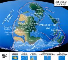
Rocks on Earth go back 3800 million years the oldest are in Greenland, followed by ones in Australia, Canada and South Africa. Most present day continents formed 3000 to 2500 million years before and have broken apart and regrouped. Most great mountain ranges were formed by collisions of continents, and occurred in phases. The first was the Caledonian (460 million years old) as Europe collided with North America; next was the Appalachian uplift in the eastern USA; about 300 million years ago the collision between Europe, America and Gondwanaland saw the Hercynian phase; and in the last ten million years the Alps were formed by the collision of the Eurasian and African continental plates, and were then deformed by faulting and thrusting.
From their rise 235 million years ago, dinosaurs dominated the land. More than 800 species of dinosaurs have been identified. The biggest, Brachiosaurus, grew to the height of 28 m and may have weighed as much as 100 tones.  There were two main groups of dinosaur: the Saurischian, or lizard-hipped, and the ornithischian, or bird hipped.  Though the dinosaurs are long gone, their descendants, the birds, are still abundant.

Geological history is peppered with catastrophes that may have been the reason why many species suddenly became extinct. One such species was the dinosaur which disappeared 65 million years ago. The most popular theory is that a large asteroid collided with the Earth, throwing dust and steam onto the air, blotting out the sun and changing the climate. A large impact crater off the Yucatan Peninsula in Mexico is often cited as possible evidence of this.